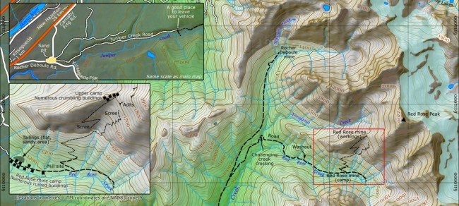
Photo Credit: Map by Morgan Hite
Juniper Creek and the Red Rose Mine
Once upon a time the old road up Juniper Creek was the main highway to a working mine situated in extreme conditions. High above treeline in the Rocher Deboule range, chunks of tungsten were cherished, while chunks of urananite, a form of uranium, were just tossed down the slope.
It all ended when the Red Rose Mine closed in the 1954. Visiting the site today you might get the impression that at that fateful hour they just shut down and walked out, because what remains is like a ghost town.
Just east of the village of Kitseguecla on Highway 16 (about 25 km west of New Hazelton), turn south on the Rocher Deboule Road. After about a kilometre, come to a sand pit on the left, where the old road begins. Your vehicle’s clearance permitting, drive the next three kilometres or so as it winds through mud holes and under low branches. Bear right at the one fork. Park where the road becomes overgrown, and ATVers have carved a detour to the left to get around a washout.
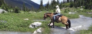
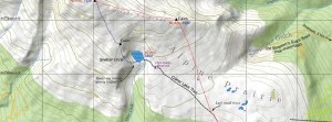
Walking the detour brings you back shortly to the old road. After about seven kilometres, the road divides, the left fork ascending and going north to another old mine site. Take the right fork. Not long after this you must cross Juniper Creek. It’s a decent, wet-foot crossing. (In 2012 there were also several handy fallen trees that hikers with good balance could take their chances on.)
The road crosses over Red Rose Creek for a short distance just before it gets to the mine’s lower camp, and instead of making two crossings you can bushwhack upstream, keeping Red Rose Creek on your right, until the road crosses back to your side.
Entering the lower camp area, you will find the remains of log buildings and a tailings pond (a large sandy area north of the road). The mine itself was in a saddle at 1700 m. The road continues on this upper camp, switchbacking up across a vast scree slope for another kilometre and a half to the spooky buildings still perched on the saddle.
Despite their exposed position, the old buildings in the saddle are in much better shape than those down in the lower camp—most still having intact roofs. In case you’re imagining that you could, in the event of an emergency, spend the night in one, let me just say it would have to be one hell of an emergency. Also, as the site is still owned by a mining company, be aware that you may be trespassing.
Taken together, the upper and lower camps are a dangerous place. Boards on the ground have multiple nails sticking out of them, and everything is loose and unstable. Don’t want to enter old shafts or tunnels. And then there’s the radiation...
Urananite is present at Red Rose in small quantities in the same vein that holds the tungsten. A radiation dosimeter reveals isolated points in the tailings and in the waste piles of rock outside the adits (tunnels) where radiation is a bit higher than background (like you would get flying in a jetliner at altitude).
Going in to Red Rose and back is a long day. It’s about 11 km one way. You could consider backpacking in your overnight gear for a more relaxed explore! The area also provides access to Red Rose and Tiltusha peaks.


